
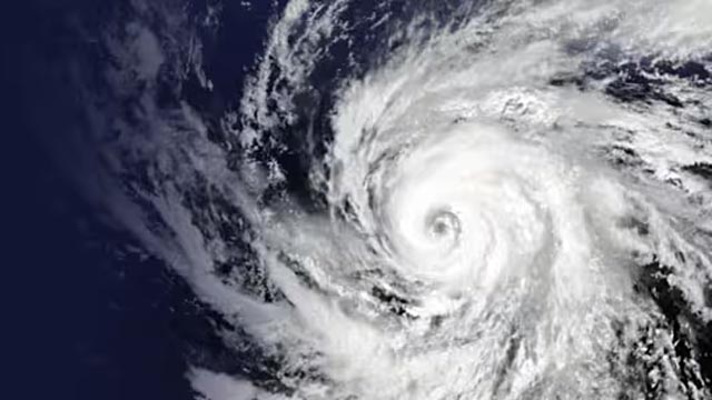
Houston: Tropical Storm Bertha has weakened into a tropical rainstorm as it moves deeper into Texas, but forecasters say the system could still bring heavy rainfall, localized flash flooding and hazardous coastal conditions in the days ahead.
The storm, which completed an unusual four-day journey across the Gulf Coast, made two separate landfalls within a short period, first hitting Louisiana before returning over the Gulf of Mexico and striking the coast again near the Texas-Louisiana border.
According to weather officials, Bertha is no longer a tropical cyclone, but its remaining moisture continues to spread across parts of Texas, keeping flood risks and dangerous marine conditions active.
Where Is Tropical Storm Bertha Heading Next?
Bertha is currently tracking west-northwest across Texas and is expected to continue weakening as it moves farther inland.
Forecasters say the system is generally moving in the direction of Houston, although the centre of the storm is becoming less organized. Most of Bertha’s rainfall has remained concentrated south of the storm’s centre, affecting coastal areas between Corpus Christi and Port Lavaca.
Meteorologists warn that even after losing tropical storm status, Bertha’s remaining moisture could trigger periods of heavy rain, especially in locations where the ground is already saturated from previous rainfall.
Residents across affected areas are being advised to monitor local weather alerts and remain cautious around flooded roads and low-lying areas.
Bertha Made Two Landfalls Along the Gulf Coast
Bertha first reached the US coastline on Wednesday afternoon, making landfall in St. Bernard Parish, Louisiana, approximately 40 miles east of New Orleans, according to the National Hurricane Center (NHC).
Instead of quickly weakening after moving over land, the storm curved back toward the Gulf of Mexico, where it regained some of the strength it had lost.
The system then made a second landfall on Thursday afternoon near Lake Charles, Louisiana, close to the Texas-Louisiana border, with maximum sustained winds of around 45 mph.
The rare double-landfall pattern made Bertha an unusual storm for forecasters, as many tropical systems weaken rapidly after their first interaction with land.
Flooding and Coastal Hazards Remain Main Threats
Although strong winds are no longer the primary concern, officials say rainfall and coastal hazards remain the biggest threats linked to Bertha.
The storm’s rainbands have continued spreading moisture across parts of the Texas coastline, creating the possibility of isolated flash flooding.
Areas that have already received significant rainfall this season could face greater risks because saturated soil reduces the ground’s ability to absorb additional water.
Meanwhile, dangerous surf conditions and life-threatening rip currents are expected to continue along parts of the northern Gulf Coast for several days as storm-generated waves move through the region.
Beach visitors are being urged to avoid entering the water until conditions improve.
Why Bertha Followed an Unusual Storm Pattern
Meteorologists say Bertha behaved differently from a typical tropical storm because of environmental conditions that affected its structure and movement.
According to climate experts, strong wind shear from the north-northeast pushed much of Bertha’s thunderstorm activity away from the storm’s centre and over open Gulf waters.
This created an uneven or asymmetric storm structure, with the strongest rainfall often occurring away from the centre of circulation.
Because of this unusual organization, Bertha maintained some strength even after its initial landfall and was able to reorganize when it moved back over warm Gulf waters.
Bertha Becomes Second Named Storm of 2026 Atlantic Season
Bertha is the second named storm of the 2026 Atlantic hurricane season, following Tropical Storm Arthur, which affected Louisiana earlier this year.
Arthur made landfall in southern Louisiana on June 17 and produced extreme rainfall, including nearly 29 inches recorded near Cottonport, according to reports.
Catastrophe modelling firm Gallagher Re estimated that Arthur caused billions of dollars in damage and was linked to multiple deaths, highlighting the impact that tropical storms can have even when they do not reach hurricane strength.
The back-to-back impacts of Arthur and Bertha have increased attention on the early part of this year’s hurricane season.
What Residents Should Do Now
Emergency officials in Texas and Louisiana are advising residents not to underestimate Bertha because of its downgrade from a tropical storm.
Authorities recommend:
- Monitoring local flood warnings
- Avoiding flooded roads
- Following instructions from emergency agencies
- Staying away from dangerous coastal waters
Officials say tropical systems can continue producing serious hazards even after they lose their official classification.
As of Friday morning, no official reports of deaths or significant damage directly linked to Bertha had been released. Authorities are continuing to assess the storm’s impact as it moves farther inland.
Why Gulf Coast Storms Remain a Major Concern
The Gulf Coast is one of the most vulnerable regions in the United States when it comes to tropical weather because of its low-lying coastal areas, dense population centres, and proximity to warm Gulf waters that can fuel storm systems.
Weather experts emphasize that a storm does not need to become a hurricane to cause major disruption. Heavy rainfall, flooding, storm surge, and dangerous ocean conditions often create the greatest risks for communities.
Bertha’s unusual path, including two landfalls within days, highlights the importance of continuous monitoring and preparedness throughout the Atlantic hurricane season.